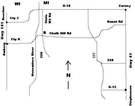
Michigan
From the North-
Option 1
Hwy 41 South. West on G18. South on State Rd W-2. 5 miles to Campground.
Option 2
Hwy 41 South. West on Banat Rd, which turns into Chalk Hill Rd. North on State Rd W-2.
From the South-
Hwy 41 North. West on either G-12 or 358. North on Hwy 577. West on Chalk Hill Rd. North on State Rd W-2.
Wisconsin
From the North-
Hwy 141 South. East on Cty K. Cross over Menominee River. North on State Rd W-2.
From the South -
Hwy 141 North. East on Cty K. Cross over Menominee River. North on State Rd W-2.